Map
Navigating the Park
Heritage Park Map
Download our map below to help you navigate all 65 acres of Heritage Park’s Historical Village!
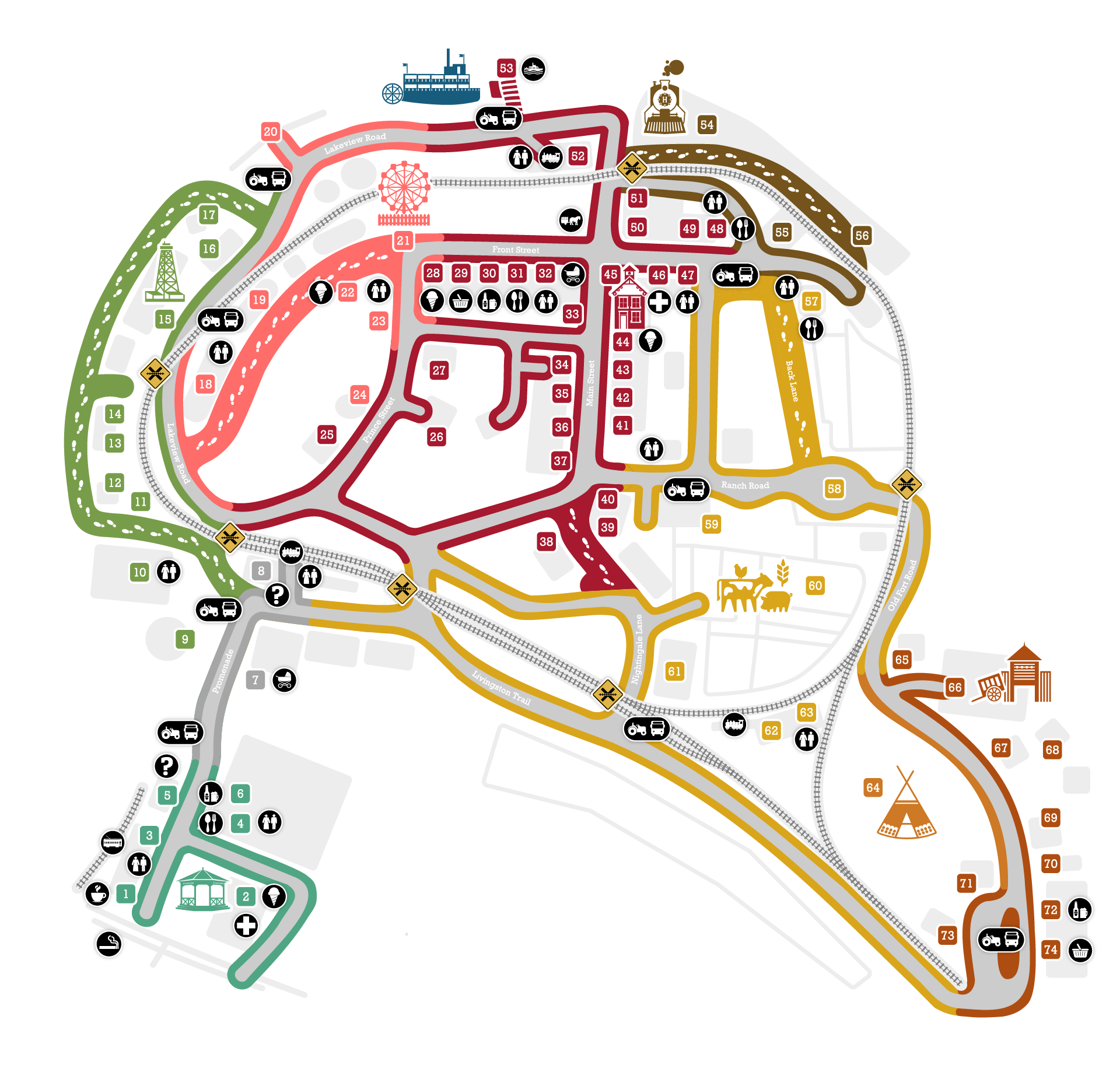
DriftScape Map
As you explore the Park, you can use the Driftscape map to get directions and learn more about exhibits in real time! Watch our for scavenger hunts and tour routes as they pop up in the app.
Getting to the Park
Location and Directions
Located 15 minutes from Calgary’s downtown core, and only 45 minutes from the YYC airport, Heritage Park sits on 127 acres of pristine parkland nestled on the banks of the Glenmore Reservoir. We’re also only an hour’s drive away from the awe-inspiring Rocky Mountains and the world-famous mountain town of Banff, Alberta.
Arriving by Car
Heritage Park is located south of Calgary’s downtown core. If you’re driving, set your GPS to 1900 Heritage Park SW and look for the parking lot signs.
Arriving by Transit
There are four city transit options to get you to Heritage Park. Bus #502 from the Heritage C-Train station (operation from May to October), Bus #20, the MAX Teal Rapid Transit Bus and the MAX Yellow Rapid Transit Bus will drop you at the foot of our parking area – which is about a five-minute walk to the Park entrance.
Plan Your Trip With Calgary Transit
Arriving on Foot / Bike
Heritage Park is conveniently located just off the Glenmore Reservoir Pathway. Bike racks are available to secure your bike near the Railway Café.
Parking
Heritage Park uses Calgary’s ParkPlus system. Pay kiosks are located on the promenade in the middle of the 6 parking lots on site. The streetcar is available to take you to the Town Square for entry into the park. If you need the courtesy shuttle to travel into the park, you can check in at guest services – through the green doors at the bottom of the clock tower.